There’s a hidden gem on the edge of Smyth County.
Don’t read that again. You’ll tire of reading it as the Southwest Virginia Sun launches its latest feature “Chasing Waterfalls.”
But … just down the hill from Troutdale – lies a hidden gem, right in plain site. In fact every hiker tackling the Appalachian Trail strolls right past it. It being Comers Creek Falls.
Now, for local folks, or visitors to the area, there’s a lot of conflicting information online, much of it paving a road to somewhere about how to get to Comers Creek Falls.
Some will tell you its a nine-mile journey, and it could be if you tack on a bunch of extra walking down side trails and such. Others will tell you to turn right in Troutdale and make like you’re heading over to the Konnarock area. Ignore all that well-meaning instruction.
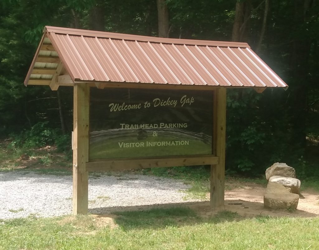
Much of the confusion dates to a couple of years back, when the US Forest Service decommissioned a 33-foot-long bridge that once crossed the creek just down from the falls. The bridge, according to the Forest Service, was suffering from structural damage. Crews out of Konnarock and from the Mount Rogers Appalachian Trail Club spent seven days taking out the bridge, which was close to mile No. 520 on the AT’s northbound trek. The Forest Service built a 1.3-mile bypass that went around the bridged area, connecting on to Comers Creek Road, Hurricane Campground Road and the nearby Dickey Gap Trail.
Nowadays, all that remains of the long bridge is scrap lumber in the creek. Workers built a set of stairs on the northbound side of the falls. In low-water times, hikers can skip across a couple of stones and not even get their feet wet. The old alternate route is being maintained as an alternative high-water route. It is marked with blue blazes.
Being on the AT, the path to the falls is white blazed.
It is the Appalachian Trail, so depending on the time of the year, expect some company. It’s not Devil’s Bathtub busy nd may never get to that level. Being so close to Grayson Highlands, many hikers prefer to go there, where the ponies graze and views are simply out of this world.
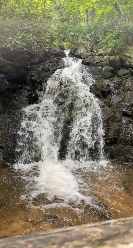
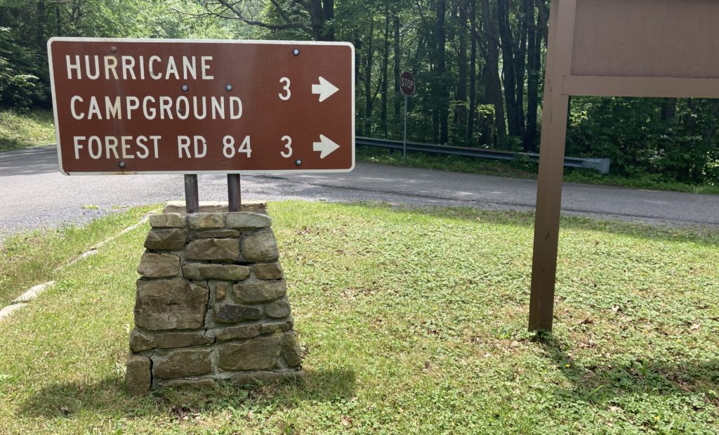
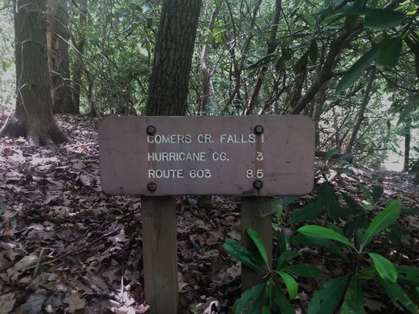
There’s a nice gravel parking lot just off state Route 16 (on the right coming from Marion and on the left coming from Independence). Once parked, cross the small road that leads to Hurricane Campground and look for an Appalachian Trail sign on the left, about a hundred feet down the road. Head down the well-marked path and stay there. Along the way, you’ll hear the water rushing but won’t see it, even when you cross a new bridge that has already been graffiti-ed by northbound hikers on April 20, 2022.
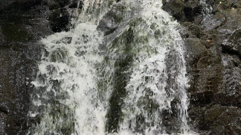
Down the newly constructed set of steep stairs, you’ll see the big payoff. Splash around a bit. Enjoy the sights, sounds and cool water and head back to the car.
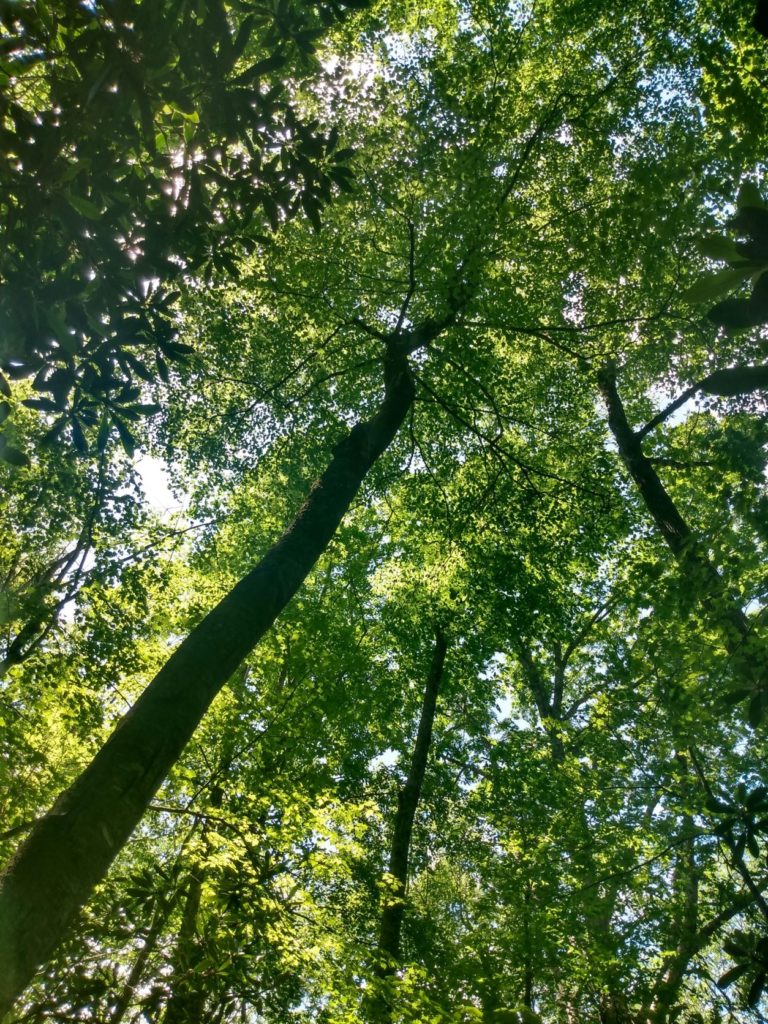
All in all, the hike to Comers Creek Falls is a pleasant stroll on the Appalachian Trail, carrying you through rhododendron tunnels along the side of the mountain to an impressive hidden cascade. The round trip is about three miles, out and back, but miles can be tacked on by tacking on side spur trails or just more deeply exploring what the AT has to offer in this section.

It’s worth noting that there is no cell service in Sugar Grove or Troutdale – the two towns closest to the falls. There is also very little in terms of eating. Pack some snacks or a lunch if you’re planning on being hungry (just be sure to pack the trash back out).
Once upon a time, Troutdale boasted the Troutdale Trading Post, which offered diner food, but we’re dating ourselves by even mentioning such a thing.
In Sugar Grove, about midway through the main drag, you’ll see the Farmhouse Market. Don’t count on it being a place to supply yourselves with snacks, though. It’s closed Sundays, Mondays and Tuesdays. It’s open from 2 to 7 p.m. on Wednesdays and from 7:30 a.m. to 5 p.m. on Thursdays, Fridays and Saturdays. The market does have daily specials, much of it local and delicious, but if you’re hiking on a Sunday, plan on stopping at Shirley’s Market, on the way out of Sugar Grove for some much more unhealthy snacks. They’ll warm you up a biscuit, slice you off a section of pizza or sell you a slab of Ne-Mo’s iced golden pound bread. That last one is non-negotiable. It’s the greatest thing in cellophane you’ll ever eat. And you deserve it. You just hiked to a waterfall for goodness’ sake. Treat yourself.
With the options for dining limited – none on the Sunday we trekked to Comers Creek Falls – we headed into Marion, hunting local food with a somewhat powerful 2 p.m. appetite. There were options that were passed by, mainly because we we’d heard of Marion’s dedicated space for food trucks.
Back in 2021, the town opened a location near a shuttered wrought iron bridge as the King’s Bridge Food Park. The park and pedestrian bridge is just in front of the town’s pool/water park, where several hundred people were out beating the early summer heat, but there wasn’t a food truck to be found. Turns out food trucks mostly only operate when you’re at work. So there’s that.
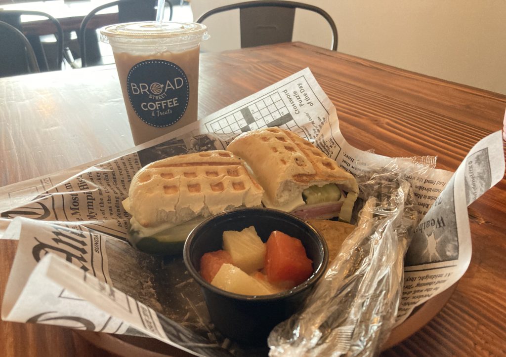
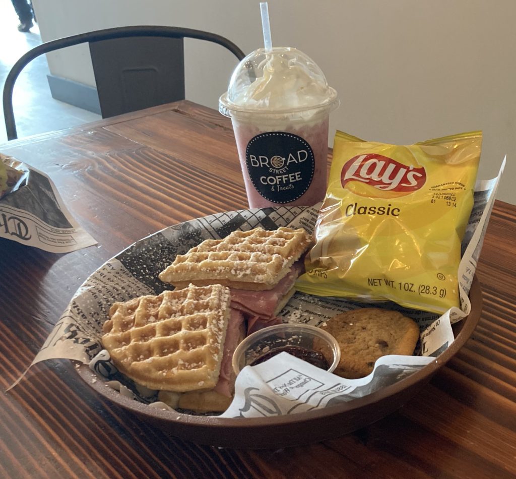

Never fear, though, Broad Street Coffee was open and not too long ago began serving breakfast and lunch all day. We picked up an iced coffee, an Appalachian soda (which somehow makes Mountain Dew even more delicious and dangerous), a waffle cristo (a Monte Cristo subbing in a powered sugared waffle in place of powered sugared regular bread) and a Cuban.
The staff there is friendly, thorough and more than competent. The food is spot on. It’s one of those places where you see the meal and think, “That’s never going to be enough,” and then it is not only enough but is more than enough.
On top of that, Broad Street is locally owned. And it supports local artists. Each month a different visual artist finds a home on a gallery wall down the coffeehouse’s hallway. So head to the cafe, even if you don’t hike to a waterfall.